|
Home : Quarterly Archives : Volume 22 |
Tredyffrin Easttown Historical Society |
|
Source: July 1984 Volume 22 Number 3, Pages 95–102 The Horse-Shoe Trail The Horse-Shoe Trail was first laid out fifty years ago, in the summer and fall of 1934. The 126-mile trail for hikers and horseback riders runs from Valley Forge to Manada Gap, where it crosses the Appalachian Trail that extends from Maine to Georgia, Starting at Valley Forge, its initial section runs through the northern part of Tredyffrin Township, along the high ridge known as "the North Valley Hill". The conception of the trail actually came eight years earlier. Two things happened in 1926 that were to be instrumental in its formation. The first of them was the purchase in the spring of that year of the Cressbrook Farm, in the northeastern corner of Tredyffrin Township, by Henry Woolman. Woolman, a graduate and trustee of the University of Pennsylvania, was an executive of the Supplee-Wills-Jones Company and had been general manager of the Woolman Dairies before their merger with Supplee-Wills-Jones. But he was equally well known as a sportsman and outdoorsman. His farm immediately became the base for his horseback riding activities on his "spare afternoons", as he rode around the countryside and on numerous old woods roads along the North Valley Hill in the Diamond Rock area and beyond. The second was a two-weeks' horseback trip taken that fall by Woolman and his friend Nelson West, along a portion of the Appalachian Trail in the Great Smoky Mountains in western North Carolina and eastern Tennessee. It was the first of four trips he was to take to that area, between 1926 and 1930, in an effort to open the foot trail to horseback riders too. "Gradually the idea germinated in my mind," Woolman later recalled, "that here at home we could have a little Smoky Mountain Trail and although the depths of the valleys were in hundreds of feet rather than thousands, the colors of the sunrises and sunsets were just as gorgeous. There were ridges and ridges stretching across Chester, Berks, Lancaster, Lebanon and Dauphin counties connecting Valley Forge and the Appalachian Trail." By early 1934 he had explored much of the nearby area on his favorite hunter, Hackaway, and determined the existence and location of a number of old trails and woods roads. The area farther away he had explored by automobile. Marking a tentative route of Topographical Survey Maps of the area, he was now ready to proceed with his idea. In early March, he called a meeting at the University Club in Philadelphia to discuss his proposal. In attendance were representatives of various interested organizations, including the Bridlewild Trail Club, the Philadelphia Riders and Drivers Association, the Delaware Valley Ornithological Association, the Radnor Hunt Club, the Perkiomen Valley Hunt Club, the Radnor Riding Association, the Pennsylvania Parks Association, the Pennsylvania Forestry Association, among others. At the conclusion of the meeting, Woolman had been elected temporary Chairman and authorized to form "The Horse-Shoe Trail Club" to locate, clear, and mark the proposed trail. The spring and summer of 1934 were spent in "exploring and temporarily marking" the entire Trail, with the help of numerous volunteers from riding clubs and other groups along the route, including groups of boys from the National Youth Administration program. To mark the trail, horseshoes, painted "quarantine" yellow, were used in addition to the traditional "one blaze for straight ahead and two blazes for a turn" in white. (The use of horseshoes as markers was later abandoned as hazardous. They were replaced with a double blaze as an alert for a change in direction, not to be passed until seeing are assuring single blaze.) By the end of the year the Trail had been laid out and marked. Much of it passed over old logging roads, abandoned roads, cowpaths, and paths used by early settlers and even Indians. It began in Valley Forge Park, ascending Mount Misery and following the ridge along the north side of the Chester Valley, turning north just before reaching Conestoga Road and then paralleling it almost to Nantmeal Village. Crossing the west branch of the French Creek and passing east of Warwick Furnace, the Trail then passed through Hopewell National Park, after which it again turned west, following an old road to Scarlett's Mill and then along a ridge past Plowville and Adamstown into the State Game Lands northwest of Ephrata. Continuing in a generally westerly direction over Cannon Hill and skirting the edge of Cornwall Forest and mines, just before Mt. Gretna the Trail climbed to the top of Governor Dick Mountain. From there it went along the Beary Ridge to Mt. Wilson and Hartranft Hill, before turning north again through the 8,000 acres of the Hershey Estates near the Hershey Hotel, and along back country dirt roads to Manada Gap, The high point of the Trail was (and is) on the crest of Stoney Mountain in Dauphin County, 1600 feet high and 900 feet above Stone Creek below.
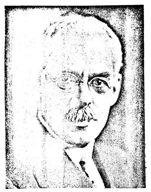
Henry N. Woolman In all cases where the Trail crossed over private property, oral permission, revocable at any time, was obtained from the owner to permit the clearing, marking, and use of the Trail across the property. (There were more than sixty-five such cases altogether.) "We have had but one refusal," Woolman observed shortly after the Trail opened, "and the Trail was easily relocated. Everyone along the line has been most helpful, and we are always welcomed as we ride by." But by the same token, exercise of the right of revocation, particularly when a property changed hands, has made necessary changes in the route of the Trail from time to time, while other changes have been made to avoid paved roads and new housing developments, or to take advantage of more scenic routes as they were discovered. And on a few occasions, the carelessness of users of the Trail has also made relocations necessary: John Goff, for many years the Trails Chairman, has recalled that his first job as Chairman was to move the Trail off one property because riders did not always close a gate after opening it, thus letting the cattle out and requiring the owners elderly mother to round them up. (At the same time, he also reported that the owner has been "most helpful and we have been good friends since the relocation".) Woolman also noted, "The linking up of old woods roads on the ridge, many abandoned country roads and back dirt roads with a few portions of new trail has been most intriguing." "Only once did the Trail cross a heavily-trafficked highway, it was pointed out in an article in the Literary Digest in 1936, and "Never during the trip is it necessary to take down a fence". (There were, however, as previously noted, some gates that had to be opened and shut.) In addition to the main trail, "Side trails to hotels, springs, and special places of historic interest are posted and marked with white blazes." Woolman also pointed out, noting that "the entire length of the Trail is interwoven with the early history of iron mining and lumbering, and if it had not been for the old woods roads and trails used to haul out the charcoal, the lumber, and the ore, the Horseshoe[sic] Trail would never have been located". In June the following year the Club was incorporated as a "permanent" corporation. Among its forty-one incorporators were businessmen and members of the state legislature and judiciary, as well as representatives of various riding clubs, hunt clubs, hiking and trail clubs, the Boy Scouts, and wildlife and conservation groups. The purpose of the Club, as outlined in its articles of incorporation, were "to open, develop, extend and maintain trails for horseback riders, hikers, mountain climbers and nature students in the wooded and mountain regions accessible from Philadelphia and Harrisburg, Pennsylvania, more particularly a trail along the crest-line of the ridges from Philadelphia through Valley Forge to the Appalachian Trail at Manada Gap, to be a feeder for the Appalachian Trail which is a hikers' trail from Maine to Georgia; to construct and maintain camp sites, open shelters and permanent camps along the Trail, to collect data of interest to users of the Trail concerning scenery, history, geology, botony [sic], forestry and wild life; to prepare maps, guide books and camping data; to encourage the use by organizations and individuals of the trails constructed and maintained by the Club; to educate the public in proper camping methods and forest fire prevention, and to foster public appreciation and use of the National and State Parks". Or, as Woolman put it much more succinctly, "Let us work for a trail in the East, free from the automobile, without gas stations, billboards or hot dog stands on the entire length of 120 miles, dedicated as a parkway from Valley Forge to Manada Gap for hikers, riders and nature lovers." The corporation was "one which does not contemplate pecuniary gain or profit, incidental or otherwise, to its members". Membership in the Club was available on a regular, sustaining, or life basis, with the landowners whose property was crossed by the Trail eligible for honorary membership. The Trail itself, however, was to be open to all lovers of the outdoors. At the organizational meeting, held at Cressbrook Farm in July, the Club's insigne - a moccasin imposed on an inverted horsehoe, the toe up, in a circle with the words "HORSE-SHOE TRAIL CLUB" around the top and the date "1935" at the bottom - was adopted. Henry N. Woolman was also elected the Club's first president. (He continued to serve as president for eighteen years, until his death in December 1953. In a resolution noting his passing, adopted at the annual meeting in May 1954, it was observed, "Without his aid it would have been impossible for the work to have been carried on. His courage, enthusiasm and confidence of success have been the life blood of the organization since its founding." In December 1972 a bronze marker on a large natural stone granite boulder was dedicated in his memory and placed at the start of the Trail at Valley Forge.) To provide overnight lodgings along the Trail, a series of fourteen Youth Hostels, at intervals of about 10 to 12 miles, was planned, giving hikers using the Trail "suitable accommodations" at the end of each day's hike. Horseback riders, who usually covered about 25 miles a day, could conveniently stop at every other one. The Hostels were operated in conjunction with the newly-formed American Youth Hostels Association, and were patterned after those found throughout Europe by the mid-1930's, after having been started in Germany. They were equipped with cabins, fire places, cots, bunks, wash rooms, haybeds, blankets, and cooking utensils. Open to members of the American Youth Hostel between the ages of "4 to 94-", the cost of an overnight stay was 25 cents to 50 cents, with fuel for cooking available for another nickel or dime. Staple foods, including milk, butter, and bread, could also be purchased. Among those aiding in the development of these hostels were Mrs. J. Hoi combe Genung, the YWCA, and the Girl Scouts, of which Mrs. Swift Newton, of Daylesford, was the director. As the Hostel program developed, various directors of the Club were also asked to visit and inspect assigned units. They were also authorized to purchase at the Club's expense "incidental small articles needed to complete the equipment" and to report the need for more expensive items. By the end of 1936 six hostels had been established, including one at Valley Forge, near the start of the Trail. It was managed by Mr. and Mrs. Jerome J. Sheas, the park superintendent for many years, and was in operation until 1945. As it became more difficult, after the Second World War, to maintain the hostels and keep them open, a few informal shelters or lean-tos were also constructed and maintained by various organizations along the Trail. The Trail's maintenance, keeping it cleared and properly marked, was under the supervision of a Supervisor of Trails (also designated from time to time as the Trails Chairman or Trails Vice President). The first Supervisor was Charles Hazlehurst, who served for 19 years before becoming Club president for eight years. The work was done in most cases on a volunteer basis by Club members and, occasionally, by cooperating Scout troops and other groups. The Scouts also helped by planting a number of seedlings along the Trail. On the second Sunday of each month the Club runs a work trip for Trail maintenance, though additional volunteer crews are also called on after a heavy storm to repair washouts or clear fallen trees and broken branches from across the Trail. (They were removed, as a report of one of the Trails chairmen, John Goff, put it, "with ax and oomph!") As early as in 1941 it was stated, in a brochure distributed by the Club describing the Trail, that the "ultimate goal of the Horse-Shoe Trail Club is to have its 116 miles made into a Trailway owned by Federal and State Governments, keeping it free from motor traffic forever". Immediately after the war there was considerable activity to have the Trail taken over by the State "as a permanent Trailway", a project described as "one of the most useful functions the Trail Club could perform". A half dozen years later it was reported that "while the project of having the Trail taken over by the State has remained uppermost ... the time and circumstances have not been propitious for pressing the matter at Harrisburg". In the following year, however, it was reported that "definite progress was being made" and that talks had been held with Governor Fine and the Secretary of Forests and Waters. Nonetheless, at the annual meeting in 1958 it was admitted that while the State had "indicated a real interest in the project", the Secretary of Forests and Waters had also "expressed concern with regard to future maintenance of the Horse-Shoe Trail should the State take it over". Accordingly, the Club resolved to continue to maintain the program. By the time the federal National Trails System Act had been passed in 1968, however, there had been a complete turn-about in the Club's position. Although the Horse-Shoe Trail probably met all the requirements to be included under the Act, when a trail became a part of this Trailways System the federal government typically sought to obtain written easements across the properties over which the trail passed, in contrast to the oral agreements that had been in effect along the Horse-Shoe Trail from its beginning, and the "broad base of mutual trust and understanding" that had developed as a result. It was also felt that such easements would probably have an adverse economic effect on the properties crossed by the Trail, and that therefore participation in the federal, program should be considered "only if it becomes very necessary". At the annual meeting in 1970 this position was reaffirmed by Trails Chairman John Goff, who observed, "If ... the Club attempted to establish it [the Trail] as a right-of-way, we would find ourselves immediately shut out from a number of acres through which the Trail now runs, and in a year or two the Trail would be hopelessly fragmented." To keep property owners informed of the Club's activities, they were included in the distribution of the Glub's new newsletter, The Blaze, introduced in July of 1968. At the same time, however, preservation of the Trail became more and more difficult, particularly in the face of suburban development and the paving of old roads. As landowners with large farms gradually gave way to former city-dwellers "seeking country places of absolute peace, quiet, and privacy", there was an increasing reluctance to permit the Trail to continue crossing over their property. Ironically, one of the earlier "incursions" onto the Trail occurred at its eastern end, on Diamond Rock Hill not far from Cressbrook Farm. In 1954 a Nike base was established on the Hill. To move supplies into the base and provide for vehicular traffic in and out of it, it was necessary to pave the old road that was a section of the Trail. Because there was only limited traffic in and out of the base, however, it fortunately did not interfere unduly with the use of the Trail. A far more serious situation developed in the same area about three years later. In 1957 a large area on the crest of the ridge was sold to an Arthur Binns for a housing development, severing the Trail at that point. At a meeting with the Tredyffrin Township Planning Commission in December of that year, representatives of the Club, the Val-Valley Forge Park Commission, and the Pennsylvania Department of Forests and Waters, together with a number of local property owners, reviewed the history of the Horse-Shoe Trail and spoke on its recreational values, its unique character, and its value to the area and the State. As a result, the developer indicated a willingness to consider modifying his plat plan to provide a 10-foot strip or right-of-way for use for the Trail. With the development, however, it was still necessary to relocate the most eastern portion of the Trail, from the Tredyffrin side of the township line to the north into apart of Valley Forge Park. With the cooperation of the Park Commission, the relocation was formally approved in early 1962. While the portion of the Trail running through the western part of this "Valley Forge Mountain" development did not have to be altered at this time, as a result of the agreement, further relocation of the Trail in this section also became necessary in early 1974. when further development in the area was made by Robert Bruce. (The problem is a continuing one. Since the Trail, as it runs through these developments, is not maintained as a "public" road, there have been practically perennial requests by some of the Trail's neighbors to have the township take it over and improve it so that it can be used by school buses, fire trucks, and other vehicles.) The growing use of motorcycles, motor bikes, snowmobiles, and other motorized devices, to the annoyance of both the property owners and users of the Trail, has also caused numerous problems. At the annual meeting in 1968 the Club's officers were authorized to cooperate in "all suitable ways" to forestall and prohibit their use on those parts of the Trail that cross private lands. In the Club's Guide Books from then on they have been described as "most unwelcome". In spite of difficulties of this sort, and the fact that paved roads now account for almost a third of the Trail, The Horse-Shoe Trail Club has continued to maintain the Trail "for horseback riders, hikers, mountain climbers and nature students", as required by its charter, through forests and woodlands and meadows, by wide cultivated fields and shady orchards. Inquiries concerning use of the Trail have been received from as far away as Louisiana. In 1949 a relay team of Boy Scouts carried a message from Mayor Bernard Samuel, in Philadelphia, over "the entire length of the Trail to Governor James Duff in Harrisburg." It is open to all at no charge, and is used by thousands of Boy Scouts and Girl Scouts, as well as hikers and horseback riders. Over the years, a number of hikers have traveled the Trail from Valley Forge to Manada Gap, and received "Certificates of Completion" at testing their feat. (As early as in 1937 it was observed that "it seemed that a certain number of well-known persons had fallen off their horses recently!". And on at least one occasion in its early days it was also noted that "men from a broken-down truck were pitching quoits with yellow horseshoes" !) The Horse-Shoe Trail is truly a "parkway from Valley Forge to Manada Gap for hikers, riders and nature lovers". It all started when an idea "gradually germinated" in the mind of Henry N. Woolman, a Tredyffrin farm-owner and sportsman.
Top References Minute books of The Horse-Shoe Trail Club Conversations with Margaret Chalfant, John A. Goff Horse-Shoe Trail Club, Guides to The Horse-Shoe Trail Henry N. Woolman, "The Horse-Shoe Trail", in The General Magazine and Historical Chronicle published by the University of Pennsylvania, January 1937 Horse-Shoe Trail Club, Reprint of an article from the Literary Digest. September 12, 1936 |