|
Home : Quarterly Archives : Volume 27 |
Tredyffrin Easttown Historical Society |
|
Source: April 1989 Volume 27 Number 2, Pages 67–76 The Boundaries of Chester County In their early schooling, pupils in Chester County are taught that the county is bounded on the northwest by Berks County, on the northeast by Montgomery County, on the west by Lancaster County, on the southeast by Delaware County, and on the south by the states of Delaware and Maryland. It is a reasonably accurate description. Yet how little it tells of the struggles and difficulties in determining these boundaries, or of the circumstances that make several of them not only unusual, but also unique! In fact, although Chester County was one of the three original counties established in the Province of Pennsylvania by William Penn in 1682, it was not until almost 240 years later that its present boundaries were finally determined. The three original counties were Chester, Philadelphia, and Bucks, but even at the outset, in establishing the county line between Chester and Philadelphia counties in 1685, there was controversy and dissatisfaction. Only a few months after William Penn had received his grant for a colony in Pennsylvania from King Charles II, a committee representing a group of Welsh Quakers or Friends visited Penn in London. Arrangements were made at that time to reserve a tract of 40,000 acres, to be "layd out contiguously as one Barony" for their exclusive purchase and settlement, a tract where they hoped and expected to be able to preserve their traditions and language and customs. A survey was made in 1684 to establish the area to be included in this Welsh Tract, begun in April and completed before the end of the year. The tract extended from Merion Township in the east to Goshen and part of Westtown township on the west. In the following year, the boundary line between Chester and Philadelphia counties was finally surveyed. As a result, the line between the two counties was unaminously established "at a council held ye 1st, 2d Mo.1685" as beginning "at ye Mouth or Entrance of Bough [Bow] Creek upon Delaware River, being the Upper end of Tenecum [Tinicum] Island, and soe up that Creek, dividing the said Island from ye land of Andros Boone & company; from thence along the several courses thereof to a Large Creeke called Mill Creek; from thence up the several courses of said creek to a W:S:W: line, which Line devides the Liberty Lands of Philadelphia from Several 1 Tracts of Land belonging to the Welsh and other inhabitants; and from thence E:N:E: by a line of Marked Trees, 120 perches [a perch is 16 1/2 feet] more or less; from thence W:N:W: by the hartford [Haverford] Township 1000 perches more or less; from thence E:N:E: by ye Land belonging to Jno: Humphries 110 perches more or less, from thence W:N:W: by ye Land of Jno: Eckly, 800 perches more or less; from thence Continuing ye said Course to the Scookill [Schuylkil1], wt h sd Scookill River afterwards to be the natural bounds". In such manner was the boundary line described. Its effect was to cut through the Welsh Tract, separating the settlements in Radnor and Haverford from those in Merion. The Welsh inhabitants of the Welsh Barony naturally protested this dividing line. In a petition to William Penn in February 1688, twenty-four of them alleged that he had given "his most Solemne word ... that they ye Petrs should have abt forty thousand acres of Land contiguously Layd" out as a Barony and that they should not be obliged to answer nor serve in any Cor': whatsoever but should have Cor^ & magistrates of their owne" and that "In consideration whereof & for a manifestation of yor petrs Love Gratitude & Choice to the sa Governor & his Governm^ they came over to this Province", in view of these assurances, they asked that they be included in neither county, and that they be permitted "to have their Co'ts & magistrates of & amongst themselves as they had in Wales and to be Governed [only] by the Laws of Pennsilvania". At a meeting of the Council in January of the following year however, several witnesses testified "that a few days before Govern' Penn left this Province" he had been asked "to decide this matter that had been so long Discussed" and that in their presence and the presence of others he had approved the dividing line as set forth by the Council four years earlier, in April 1685. On the following day two landowners from the Tract, Thomas Lloyd and John Eckley, appeared before the Council, this time to request that it "show cause why they should not be declared of the County of Chester [rather than Philadelphia]", but their oral testimony, without written evidence, of their expectation of a separate barony was not considered sufficient to convince the Council. The line was accordingly confirmed, though this time not unaminously. When a part of Philadelphia County became Montgomery county in 1784, the new county included much of that part of Philadelphia County that bounded Chester County on the northeast, along the Schuylkill River. As a result, Chester County has since been bounded on the northeast by Montgomery County. As one of the three original counties, the western boundary of Chester County was originally the same as the western boundary of the Province, established in the grant to William Penn as a meridian five degrees west of the Delaware River. Thus Chester County originally encompassed all or parts of some two dozen of the present day counties of Pennsylvania. But just as increasing numbers of settlers led to the creation of Montgomery County from Philadelphia County, so growth and development farther to the west had, fifty-five years earlier, led to the formation of Lancaster County out of the upper or western part of Chester County in 1729. In February of that year, the Council received a petition "of the inhabitants of the upper parts of Chester County ... setting forth, that by Reason of their Great Distance from the County Town [then in Chester], where Courts are held, Offices are kept, & Annual Elections made, they ly under very great Inconveniences, being Obligated in their Recovery of their just Debts to travel near one hundred miles to obtain a Writt; that for Want of a Sufficient Number of Justices, Constables & other Officers in their parts, no care is taken of the high ways; Townships are not laid out, nor Bridges built, where the need for them is an apparent Necessity for them, & further that for the want of a Gaol there, several Vagabonds & other dissolute People harbour among them; thinking themselves safe from Justice in so remote a Place; And therefore praying that Division Line be made between the upper and lower parts of the said County, & the upper part thereof Erected into a County, with all the Immunities, Rights & Privileges which any other County of this Province does now Enjoy". Two weeks later a committee of twelve persons was ordered to meet with John Taylor, the surveyor for Chester County, at "some convenient place near the Octararoe Creek or River, & cause a mark'd Line to be run from the most northerly or main Branch of the said Creek Northward ... to the next high Ridge of barren or uninhabited Hills that trend from thence to the Schuylkill River, keeping as near as may be to the Ridge of said Hills.. . [the new county thus] to be bounded Southward by the Southern Bounds of the Province & Eastward by the said Octararoe Creek; and from thence the Northern Line ... as aforesaid". The committee made its report, with a detailed description of the survey, in early May. The report was then "read, approved & confirmed", and the upper part of the Province was "accordingly Erected into [a] County, by the name of Lancaster County". In a similar action, twenty-three years later, in 1752, Berks County was created out of parts of Philadelphia and Lancaster counties and a small part of the northwestern corner of Chester County. While resurveys of both these boundary lines were made in 1801 and again in 1849, the adjustments in them were minor and the lines basically were not changed. And thus Chester County no longer extended to the Western Reserve, but was bounded on the west by Lancaster County and on the northwest by Berks County. But it is the southern and eastern boundaries that are generally considered the more interesting. The boundary on the southeastern corner is truly unique. Aside from the hypothetical high school geometry problems which start out, "A farmer has a circular field in which --", it is perhaps the only circular boundary extant. This anomoly resulted from the charter granted to William Penn in 1681, which fixed the southern boundary of his province, in part, as "a circle drawn at twelve miles distant from New Castle, northward and westward". As this section of the colony became more settled during the next decade or so, there developed a need for a survey to determine the exact location of this boundary line for taxing and other purposes. Finally, in 1701 a warrant was issued, directing the surveyor of Chester County, Isaac Taylor, and his New Castle counterpart, Thomas Pierson, to make a survey of this circular line. Immediately there arose a question as to what point in New Castle was to be considered the center of this circle with 12-mile radii. Since William Penn was by then the proprietor of the three "lower" counties as well as the proprietor of Pennsylvania, however, it was a question quickly and amicably settled; at a meeting of the two surveyors with the magistrates it was decided that the center of the circle would be "at the end of the horse dyke next to the town of New Castle". The survey was begun in late June of that year, and completed in October. The arc was determined by measuring successive chords of sixty-seven perches each. Starting at a point twelve miles due north of "the horse dyke", the first chords were drawn from this point one degree south of east and west. As each chord was measured and marked, the surveyors then changed their direction one degree to the south, finally determining 120such chords, 43 to the east and south to the Delaware River, and 11 to the west and south, completing the arc they were commissioned to draw. Fixing the remainder of the southern boundary of the county and the province was considerably more sontested, involving a fifty-year dispute between Pennsylvania and Maryland. The dispute, in fact, was not fully resolved for another three decades after that with the famed Mason and Dixon line, about which much has been written. The dispute between the Penns and successive Lords Baltimore stemmed in part from the lack of reliable maps of the new world and in part from a carelessness in the issuance of grants or patents for land in America. As a result, in more than one instance grants for the same lands were made to more than one person. In brief, by the description in the grant made to Lord Baltimore in 1632, the colony of Maryland was bounded on the north by the fortieth parallel of north latitude, but the grant also specifically excluded any territory previously cultivated, described in the grant by the Latin phrase "hactenus inculta". In the grant to William Penn forty-nine years later, the southern boundary of Pennsylvania was similarly defined as the fortieth parallel of north latitude, but it was also provided that his colony was to be bounded "on the south by a circle drawn at twelve miles distant from New Castle northward and westward [as previously noted] unto the beginning of the fortieth parallel of North latitude and then by straight line westward". The problem was that the fortieth parallel of north latitude actually runs about thirteen miles north of this circular boundary, and therefore cannot, as implied, intersect with it! From a more practical standpoint for Penn, however, was the fact that the fortieth parallel also ran north of the proposed site for Philadelphia and that his colony would therefore have been deprived of its most favorable location for a harbor and seaport. He therefore contended that the intent of the charter for his colony was that it should extend at least as far south as the circular boundary twelve miles north of New Castle, with the boundary line between Pennsylvania and Maryland drawn westward from some point on the circular boundary. This interpretation obviously overlapped Maryland's claim. The Crown's solution to the dispute was simply to order Lord Baltimore and William Penn to work it out between themselves. Various suggestions, most of them impractical and unscientific, were made. One proposal made by Penn, allegedly at the suggestion of the King, was to determine the location of the fortieth parallel by measuring north from Cape Charles, by agreement located on the north latitude of 37°O5', at the rate of 60 statute miles to a degree. (Since a degree of latitude in this zone is actually about 69-1/2 miles, the obvious result would have been to place the fortieth parallel almost 28-1/2 miles to the south of its true location.) In the face of proposals such as this, the meetings between the two proprietors or their representatives resulted in no real progress at all. With the matter thus deadlocked, in 1685 it was referred to the Board of Trade and Plantations in England for arbitration, a solution presumably advantageous to Pennsylvania as William Perm's standing in London was probably more favorable than Lord Baltimore's. During the review by the Board, Penn suggested that Lord Baltimore's claim to the disputed area was precluded by the existence of the Dutch and Swedish settlements along the Delaware River even prior to the grant of the charter for Maryland, thus making the area "hactenus inculta", and excluded from Lord Baltimore's grant. While it hardly seems likely that it was the intent of the King to give this protection to settlements of other countries, nonetheless it was informally recommended by the Board that the boundary line between the two colonies be established along a line fifteen miles south of the southernmost part of Philadelphia, a line about 19 miles south of the originally designated fortieth parallel of north latitude. For various reasons, the matter then lay dormant for a number of years. But with the growth in the population in the disputed area and, again, the need to establish jurisdiction over it for the collection of taxes and other matters, in 1731 the dispute broke out anew. Once again the current Lord Baltimore petitioned the King for an order requiring that the two provinces establish a boundary. In the following year, the sons of William Penn and the grandson of the first Lord Baltimore agreed to have a survey made to implement the 1685 recommendations of the Board of Trade and Plantations. This line was "to be considered the true boundary of Maryland and Pennsylvania". In the agreement it was also specified that the line should be "well marked by trees and other objects, and designated by styone pillars, sculptered with the arms of the contending parties, facing their respective possessions". Efforts to survey and establish this "true boundary", however, continued to meet with repeated resistance and "ingeneous delays" on the part of the Maryland authorities. In 1735 the Penns filed a bill in equity to compel specific performance, but the obstructive tactics of Lord Baltimore prevented disposal of the case until 1750, when Lord Harwicke again reaffirmed the 1732 agreement. Still little progress was made. Questions were again raised as to from what point in New Castle the twelve-mile radii for the circular boundary should be drawn, whether the twelve-mile radii whould follow the contours of the ground up hills and down valleys or be a horizontal line, and similar details. (One suggestion to determine the center of New Castle was to draw a map of the town and then balance it on a pin!) When it was finally agreed that the Court House would be considered the center of New Castle, the Maryland representatives then sought to have each of the more than 100 radii surveyed and chained, in lieu of the use of chords to define the boundary. The matter was finally resolved in 1760, after almost 80 years of contention, when a new deed, incorporating the boundary line of the 1732 agreement, was issued to the new Lord Baltimore. (A new deed was necessary as a result of inheritance technicalities.) The Lord High Chancellor also ruled that horizontal measurements were to be used, that the center of the belfrey of the Court House was the center of New Castle, and on other disputed details. Commissioners were also appointed to see that the survey was completed. The assignment, and its required sequence of surveys, was not an easy one; the work involved many technological problems and the application of complex mathematical calculations. Progress, in fact, was so slow that it was soon deemed advisable to petition for additional assistance from the Astronomer Royal. The two men named by the Astronomer Royal to assist in the project were Charles Mason and Jeremiah Dixon, whose competence in mathematics and astronomy had been well established. In August 1763 they entered into a contract to complete the survey, arriving in Philadelphia three months later, on November 15th, to begin the work. Their contract called for payment of one guinea per day, plus expenses. Their journals provide a complete and detailed record of their activities that resulted in the well-known Mason-Dixon Line. Arriving in Philadelphia, their first task was to determine the latitude of the "most Southern part of the City". To make the necessary observations, they set up an observatory at a point on Cedar (now South) Street from which they could determine its latitude. Since a point fifteen miles south of this point would be in New Jersey, they then traveled west about thirty miles to a location at the same latitude, on the farm of a John Harland, near the present Embreeville. It took two days to cover the thirty-one mile distance by wagon, great care being taken to avoid damage to their delicate and sensitive instruments, some of which were placed on featherbed mattresses for the trip. At Harland's farm they again set up their observatory, and also planted a marker, now known as the Stargazer's Stone, as a base for their operations. (At this observatory, in addition to their survey work on the boundary line, Mason and Dixon also made other scientific observations, including the recording of a lunar eclipse and studies of one of the satellites of Jupiter.) After a review of the survey attempts that had been made previously, the two surveyors began work on five separate surveys: to determine the tangent line north from the middle point of Cape Henlopen to the circular boundary; to determine the tangent point on the circular boundary; to fix a line north from that point to a point fifteen miles south of the latitude of the southernmost part of Philadelphia (and of the Stargazer's Stone); to measure the distance from that point to the Delaware River, in order to locate the southwest corner of Pennsylvania at five degrees west of the Delaware; and, finally, to draw a line west from that point, which was to be the "true boundary" between Pennsylvania and Maryland and, for its first eighteen miles, part of the southern boundary of Chester County. The methods used to make these determinations are described in detail in their journals. To attempt to summarize here the various, and at times quite complicated, astronomical observations and mathematical computations would probably serve only to make this account, as Wilmer MacElree once put it, "more voluminous, but less luminous". In their work they were also frequently hampered by stormy or cloudy weather that interfered with their observations. Having determined that the southernmost point of Philadelphia was at39°43'17.4" north latitude, by June of 1765 they had also fixed the point due north of the tangent point on the circular boundary, from which they were to draw the boundary line, and marking of the line begun. Stones with the letter "M" on one face and the letter "P" on the opposite side, brought over from England, were placed at one-mile intervals along the line, with a larger "crown" stone with the coats of arms of Lord Baltimore and William Penn marking every fifth mile. Actually, the survey was stopped about twenty-one miles short of the western end of the boundary because the Indians accompanying Mason and Dixon refused to go beyond a point near Dunkard Creek and into the territory of the Six Nations, but this is hardly relevant to the boundaries of Chester County as the Octararo Creek had long since marked the western limit of the county. Incidentally, all but one of the eighteen stones marking the Mason-Dixon Line along the southern boundary of Chester County are still standing, and many of them can be reached with relatively little difficulty. With the starting point of the Mason-Dixon Line (and thus the northeast corner of Maryland) located on the tangent line rather than the circular boundary itself, between these lines there was a small wedge of about 700 acres, about three-quarters of a mile wide at its northern end and tapering to a point three and half miles to the south. Although it was south of the latitude describing the southern boundasry of Pennsylvania and the state never exercised any authority over it, geographically it was shown on most maps of the area as a part of Pennsylvania and Chester County. Thus at the southern end of the wedge it was theoretically possible to jump from Maryland over Pennsylvania into Delaware. While the state of Delaware attempted to exercise jurisdiction over it, the wedge became a sort of "no man's" land for years and a haven for fugitives and law breakers who challenged each state's claim to jurisdiction. It is reported that it was the scene of prize fights, dog fights and cock fights, illegal in each of the respective states, and was even proposed as the site for a duel involving James Gordon Bennett, publisher of the New York Herald, though for some reason the affair of honor instead took place in the Carolinas. It was not until 1894 that a joint commission was established to resolve the problem. It recommended that the wedge should be a part of Delaware. While the Pennsylvania voted in 1897 to accept this recommendation, it was not approved by Delaware until 1921. On June 30th of that year the United States Congress passed a resolution recognizing this joint action, making the area officially a part of the Blue Hen state and finally establishing the southeast boundary of Chester county. Finally, we come to the lower part of the eastern boundary. When Chester County was first established it also included what is now Delaware County, with the county seat in Chester. (Incidentally, it is claimed that the old court house in Chester, built in 1724, is the oldest public building still standing in the United States, eleven years older than Independence Hall, and older than Boston's Faneuil Hall by 18 years.) With the growing settlement of the western part of the county during the first half of the eighteenth century, in 1766 a petition was presented to the General Assembly, pointing out the difficulties of the 30- or 40-mile distances it was necessary to travel to the county seat and court house in Chester to conduct divers official business and requesting that the county seat be relocated "as near to the center of the county as might be". As is so often the case, nothing came of this petition at this time, but fourteen years later an Act was passed by the Assembly to create a seven-man commission to purchase land in a more convenient place, and to erect thereon a new court house and prison. Another four years later, in 1784, in a supplemental Act, it was specified that the new court house should be located within one and a half miles of the Turk's Head Tavern, in what is now West Chester. Despite protests from the business community of Chester, allegedly including the organization of an armed mob to teardown the partially constructed new building, in that year a new courthouse and gaol were built directly across from the tavern, and the seat of government moved. Four years later, however, in 1789 the people of Chester, finding themselves at a similar disadvantage in the conduct of their official business, presented a petition to the Legislature, in which they requested the establishment of a new county and separation from Chester County. In that same year the Assembly approved an Act dividing Chester County in two, creating from the eastern section a new county, to be known as Delaware County. The Act also specified that the upper part of the boundary between the two counties, extending north from a point on the Brandywine Creek, was to be "as nearly straight as may be so as not to split or divide plantations". As a result of this provision, in some places the boundary line between Chester and Delaware counties today is somewhat zig-zag and far from straight as the owner of each farm or "plantation" bisected by the proposed line was given his choice as to the county seat in which he preferred to conduct his affairs, and thus as to which county his land would be located. The lower part of the boundary is the middle of the Brandywine, with the lands to the east of the creek in Delaware County and the lands to the west of it in Chester County. The course of the stream is a winding one, and, interestingly, after it flows down across the circular boundary into Delaware it curves back north and east into Pennsylvania again before twisting back into Delaware and on down to the Christiana River. Thus apart of Birmingham Township, even though if lies on the west side of the creek, is separated by more than two miles from the rest of the township and county. Thus a small part of Chester county is also actually bounded on the west by Delaware County! And so, after litigation over the autonomy of the Welsh Barony, the creation of new counties as Pennsylvania became more settled, the anomoly of a circular boundary, contention and disagreement for more than 80 years with Maryland and the successive Lords Baltimore over the southern boundary that resulted in the Mason-Dixon Line, a near pitched battle at the court house and the creation of a new county on the east that left a part of Chester County that is not contiguous with the rest of the county, and finally the elimination of a wedge of "no man's" land, Chester County is bounded on the northwest by Berks County, on the northeast by Montgomery County, on the west by Lancaster County, on the southeast by Delaware County, and on the south by the states of Delaware and Maryland.
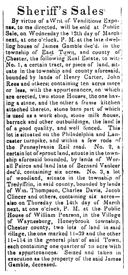
from the American Republican February 19, 1833
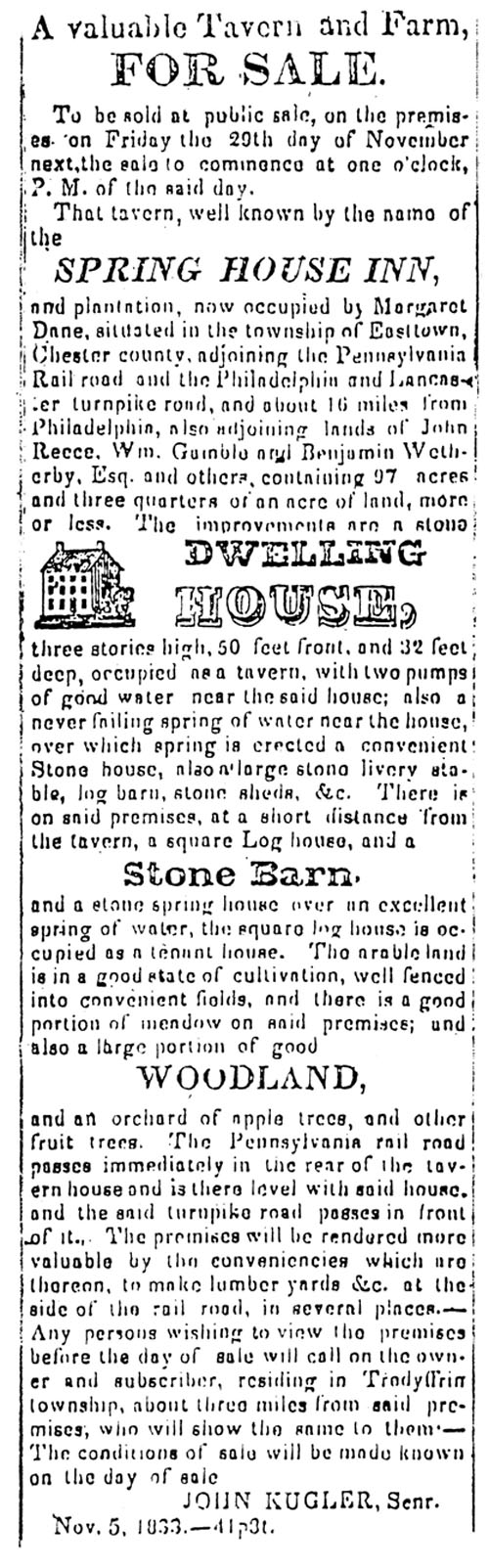
from the American Republican November 5, 1833 |