|
Home : Quarterly Archives : Volume 35 |
Tredyffrin Easttown Historical Society |
|
Source: January 1997 Volume 35 Number 1, Pages 21–28 Darby Creek Valley Association: Guardian of a Stream If you look at a map, you will see the southeastern course of the Darby Creek from its headwaters in Easttown, Tredyffrin and Radnor townships to its outlet at the Tinicum marsh into the Delaware River. This is the Darby Creek watershed. One of the things that is very interesting is that the word "watershed" really was not used that much in our lifetime, in the broad sense, although I happened to see something in a little book that was printed in 1932 about "King's Woods" where, believe it or not, they had a large convocation bringing students in the metropolitan area together at the University of Pennsylvania to get them involved in a project, and the project was to get to know the Delaware watershed. When you talk with people today about watersheds, one of the first things they say is, "Well, what is a watershed?" It's a drainage basin, so what you see is a thirty-some odd mile stretch of the watershed. The water runs into the main Darby, and the Little Darby, of course, becomes the main Darby and so on all the way down to the Tinicum, at the Delaware, which is the only fresh water tidal marsh,, one of a few, in the country. All of this has been saved through a lot of public pressure. They wanted to drain more of it, and would have had almost nothing left. So we are talking about a large thing. [Note 1] There are a great number of creeks in Delaware County. One of the reasons why the county was so prominent historically was because of the number of creeks. They provided the access way for the mills to be developed into the interior. On the Darby, one of those farthest upstream was the paper mill in Newtown Township, very near to Easttown. We had a series of mills along the way over a period of time, particularly being developed in the eighteenth century, and providing, of course, the sorts of things people needed most, the grinding of the grains to make the flour, and saw mills, in particular. By the late eighteenth century we began to get paper mills, and then the industrial revolution burst onto the scene in the nineteenth century and Delaware County became one of the most prominent counties, one of the wealthiest counties, in the United States. Size-wise, it is not a large county Commonwealth-speaking, but the population has been quite large (although we've been on a downward trend in the more recent years because of the loss of certain kinds of manufacturing, particularly along the Delaware river waterfront area). One of the things I should mention is how we really got involved in looking after the Darby Creek back in 1970, the first Earth Day. Some of the high school students came home and said that there was raw sewage going into the creek. I said, "That's a figment of your imagination." They said, "Well, come and see." Seeing is believing, and raw sewage was going into the creek. If you think of it, you could only really expand development to the extent you had sewage treatment plants, and when those older facilities became overloaded, they would just dump it into the creek, [Note 2] So finally the log-jam was broken. The Haverford-Radnor-Marple Authority was established, and now all of our sewage goes down to the Southwest Sewage Treatment Plant (although we have a number of spots as you do in Chester county that are on-site sewage). Chester County has greater and greater problems as time goes on because of the saturation of the soil, and the problem of leaching from the septic tanks. From that, we began to get an image of the Darby Creek as an entity. Then, when The Grange was going to be sold at public auction, the municipality moved to save it, and that was our cliffhanger - about four weeks to save the property. There was no other time for historic preservation because they had lost a major property over at Episcopal Academy. The headmaster at the school said if you get rid of it on Saturday, they won't know that it's gone, and that's exactly what happened. On the back of the "Preservation News," from the National Trust for the month following, is the picture of the wrecking ball hitting that building. So, needless to say, people who thought about, and were talking about, the reality of the situation did not think The Grange would ever be saved. Well, it was saved, and the historical legacy has really moved downstream because we also have the Swedish cabin which was in jeopardy at that time, and then also the Lukens Inn, on the corner there, just up on State Road, that was in jeopardy and finally was sold for a restaurant. A few, maybe two, acres were saved of the original plot, probably not even that. But then the whole idea began to sort of fall into place, and the Darby Creek Valley Association was founded in 1983 as the result of a lot of little different groups finally coming together.That DCVA has continued to the present day. It's through that group that we developed our educational program for the watershed itself, which is holistic in nature. It includes archaeology (which brings it up to present day), and water testing, which is what we are going to be doing this fall. So some of you in the History Club might be interested in the headwaters of the Darby Creek which happen to be in Chester County, maybe even monitoring a few of the little runs there. That's what we are trying to get, local stewardship of each little run, because that makes it easier in a lowland. We also have some papers that can be distributed among the people who own the runs that tell how to care for your creek, [Note 3] We had our first education program in 1985, and we started out with the little children who are involved in that program. It's hard to believe how time passes so quickly, but it does. And we now have expanded the program. Not only do we have the education program for the children, but we have provided resources for the school. For instance, one of the schools this spring had an emphasis on Earth Day, and we were able to bring a variety of resources, and to really network a watershed program for 500 children in the school. So that's another service in addition to the educational program. An example of a DCVA project which has suceeded in reducing the amount of trash pollution is the Annual Darby Creek Cleanup, which was first held in 1985. In recent years, close to 1000 volunteers have turned out on the last Saturday of April to help rid the creek and environs of refuse such as old car parts, broken appliances, twisted mattress springs, bent bicycle wheels and other assorted pieces of trash. We have also developed library corners in the various libraries within the watershed. We're expanding those and we hope to take them up into the headwaters of Chester County as well. We will have copies of the map we have produced, and also descriptive materials of the Darby Creek, and we'll be asking people to bring together any materials they may have on the Darby Creek. For instance, one of the articles that we have was written in 1910 by a gentleman who lived in Lansdowne. He had a dream for the Darby creek that it would be the new Wissahickon. The dream was that, in essence, the watershed would be saved in the long-run, and that it would provide a spot of local beauty and also the preservation of the heritage within this area of the county. Maybe by 2010 we'll have it in place. The idea that the DCVA had is to develop the Darby Creek Heritage Greenway all the way to the headwaters, and that it will preserve a riparian buffer not only on the mainstem of the Darby, but all the tributaries.In essence, it will become a ribbon of green and a ribbon of blue - clean blue if you wish - within Delaware County. So, they are the kinds of things we are working on to rehabilitate the Darby. There was a comment on the preservation of open space in the newspaper recently. The Jenkins Arboretum was just purchased by Tredyffrin Township for a million dollars for the preservation of it as part of their open space plan. The funding would go into the trust to be set up to manage the arboretum at that particular point. You'll be seeing more and more purchases of open space by municipalities. Nether Providence is going to spend (it's an escalating fund -a large spend) between two and eleven million dollars for tracts of land in that section of the county. So things are happening that, like many things in the past 20 years, have been sort of piecemeal where there has not been a network of pulling everything together. Since 1990, the Darby Creek Valley Association has been one of the founding members of what we call the Delaware County Environmental Network. Simply put, its goal is to network all the groups that have an active interest in the preservation of the quality of the environment within the county. Soon we will be publishing the second Environmental Directory. That should come out within the month. So that's a way in which local citizens can become aware of what's available, and also by membership in the DCVA. We also have our quarterly newsletters that make people aware of what's happening within the county. Remember our Green Again initiative on the ballot last spring to borrow funds for acquisition of open space? It didn't happen in our county, but it did in yours. You had a bond issue in Chester County that was successful. While it did not happen here, I don't think that it's going to fail in the preservation of open space in Delaware County because local initiatives are building now and, hopefully, out of that will come coalitions within the watershed, so we'll see that the areas are protected. I should mention, too, why we have a Chester-Ridley Watershed association as well as the Darby Creek association. Why wasn't the Darby part of the initial group? Because of raw sewage running into the Darby, and one won't find that in the Chester-Ridley. They didn't want to be associated with the Darby because of their pollution. It might be a good idea to bring them all together and be concerned collectively about pollution, but that is why we had a separation. TopNotes 1. For the statistically-minded, the headwaters of Darby Creek rise near Berwyn and flow for 30 miies in a broad, sweeping valley to the Delaware River at Tinicum just west of the Philadelphia Airport. The creek passes through 12 townships and 15 boroughs, draining over 80 square miles of eastern Chester County, northern and eastern Delaware County, and a small portion of Montgomery and Philadelphia counties. Cobbs Creek, a major tributary of the Darby, joins it at Sharon Hill. Darby Creek figured in one of the earliest settlements in what is now Pennsylvania by the Swedes, In 1643, the Royal Governor of New Sweden, Johan Pnntz, chose Tinicum Island at the mouth of Darby Creek for both a residence and a fort. [See TEHC Quarterly, Vol. I, Nos. 3 and 5, 1938.] During this era of settlement, almost 40 years before the arrival of William Penn, the lower Swedish log cabin on Creek Road in Upper Darby Township was built. It is the only remaining cabin of several once located along Darby Creek. Another legacy of this settlement is the contribution made one hundred thirty years later by John Morton, of Swedish descent, one of nine Pennsylvania signers of the Declaration of Independence. 2. A story on page two of The Philadelphia Inquirer of Sunday morning, July 12, 1970 by Mike Clark, carried a headline "Radnor Turns Clean Darby Creek Into Sewer." The text which followed described a not too pretty picture. "Pollution in Darby Creek gurgled into the public eye last week," says Clark, "when an electrical failure resulted in more than 300,000 gallons of raw sewage being dumped into the creek. The power failure knocked out pumps of the Radnor-Haverford-Marple (RHM) Sewage Treatment Plant, and the sewage ended up in Darby Creek. The spill prompted State Health Department officials to warn residents away from the stream until the water became less polluted and the health hazard passed .... "In a report dated Spring, 1970, a University of Pennsylvania student, Sandra Speers, reported that until the stream reaches the plant, it has to be considered 'fairly good' based on water quality tests. The water is clean and, except for natural brush and some logs, contains very little debris, There is some evidence of phosphate and nitrate enrichment from small sewage treatment plants above the RHM plant, "In her report, Miss Speers said the creek takes a double jolt of pollution from which it never recovers. The first is the RHM plant itself, and the second is from the Delaware County Incinerator in Marple township. The incinerator uses 'quench water' to cool down things that won't burn, such as tin cans. The resulting mountain of junk is watered down, and the quench water seeps into the creek and adds considerably to pollution. In addition, she points out that residents apparently feel no qualms about dumping their refuse into the creek. Significantly, Miss Speers says, "as land use intensity and density increases, water quality of the stream decreases, " and there is no better way to prove her statement than by a visit to the creek. "On a sunny, warm day in Radnor Township, Darby Creek looks as clear and clean as the freshest of mountain streams. As the creek emerges from under the bridge on Goshen Road in the vicinity of Bryn Mawr Avenue, the sunlight sparkles off the ripples of water, and a close look shows minnows swimming in the slowmoving water. Along the shore, expensive homes are built just off the flood plain. At the concrete outlet pipe of the RHM plant, the story changes. The smell of decay is almost overpowering. Dark green - almost black -- slime coats the shore line. Even the bark of the trees looks sick .... and it gets worse and worse and worse until the water empties into the Delaware River in Tinicum Township, bearing little resemblance to what it started out as in Chester County ...." Clark's news story concluded on the hopeful note that something was being done. "Steve Chamberlain, associate director of the Planning Commission said the creek had been assigned a pollution abatement schedule by the Delaware River Basin Commission that will limit the amount of sewage entering the creek by 1973 .... Chamberlain is trying to firm up a date for a meeting between the [Darby Creek] association, the Delaware River Basin Commission and the state sanitary board. He's hoping for September sometime ...." 3. The runs which form the beginnings of Darby Creek drain southward off the ridge of the South Valley Hill in Easttown Township. An easy way to locate them is to travel on Sugartown Road east from Darby- Paoli Road (today's PA Route 252) and observe the bridges and culverts carrying the road over the streams. The first run encountered passes under Sugartown Road at a bridge south of the YMCA property, a few hundred feet west of the intersection with Abbey Road, begining to the north at the Oak Knoll development off Glenn Avenue, near the Daylesford railroad station. Just north of the bridge, on the YMCA tract, is a pond or dam. The restored farmhouse on the south side of the road (once a part of the historic Waynesborough estate of Gen. Anthony Wayne) displays a sign "Rock Creek Farm" and is surrounded by a 1980s development of expensive homes. Why the builder selected the name Rock Creek raises an interesting but unanswered question. Three-tenths of a mile further east on Sugartown just short of the intersection with Leopard Road, a culvert carries a weaker run beneath the road. This run drains 100-plus acres to the north once owned by Joseph Sharp. It rises near the intersection of Berwyn-Paoli Road and today's Lenape Drive. To the south of Sugartown Road, it passes through Sharp's "Hawthorne" estate and joins the first run mentioned above on its way east to the mainstem of Darby Creek. To the east another four-tenths mile, near the Waynesbrooke development, a substantial bridge carries the road over the flow of two runs which originate just south of Lancaster Avenue in the western reaches of Berwyn. One begins on the west side of Leopard Road behind the strip of commercial properties on Lancaster Avenue, while the other has its origin on the east side of Leopard in the vale below the Trinity House senior citizens apartments. They join on the east side of the road below what is today the Whitlock Center of Devereux Schools, and together flow south under Sugartown Road into Leopard Lake and beyond to meet the earlier mentioned runs. The mainstem of Darby creek flows under the next bridge on Sugartown Road located almost opposite Church Road another seven-tenths of a mile further east. The stream bridged there collects the waters of as many as five runs rising in the low, flat lands to the north between east Berwyn and Devon. Three of them spring out of the ground north of the tracks of the railroad, and require culverts to breach the railroad embankment. On the west a springhouse north of Old Lancaster Road, near Littlebrook, marks the source of one of these runs. It passes under the railroad east of the Bronze Building in Berwyn near the place where Old Lancaster goes under the tracks, and is joined below Doyle & McDonnell's property south of Woodside Avenue by another run which originates at the site of the old Berwyn ice plant west of the Bronze Building. Another run originates near the western end of Highland Avenue north of the railroad.Its source was filled by an early developer, but the original culvert under the railroad can be seen to the south. This weak stream meets the Littlebrook run on the Doyle & McDonnell property. A stream identified as 'Devon Run" on a 1912 map begins at a springhouse along Waterloo Road in Devon, north of the railroad embankment. It flows under the tracks in a culvert beside the Waterloo Road underpass. This run is a strong one. It supplies the Devon duck pond on the grounds of Devon Manor, and flows south to meet another small run which originates south of Chester Road, near the i ntersection of Arlington and Berkeley roads. They join a little further west with the stream draining east Berwyn at a point near the Sugartown Road bridge and then head on toward Waterloo Mills to the south. Other streams rising in the southern reaches of Easttown Township join in the now significant stream at Waterloo Mills, site of the only grist mill in the township. The Darby Creek exits Easttown into Newtown Township over what is shown by a 1912 map as Charles Custis Harrison's "Happy Creek Farm." Actually, Happy Creek is yet another tributary of the Darby, rising in the southeast corner of Easttown to flow also through the Harrison farm and join the Darby mainstem in Radnor Township below St. David's Church and Newtown, One source of the Darby Creek, the Little Darby, rises in southeastern Tredyffrin Township and flows under Sugartown Road a mile and one-half east of the mainstem crossing at Church Road in Easttown noted above. It is obscured today by asphalt paving at what is the southeast corner of the Devon Square Shopping Center. The run originates in Strafford north of the railroad, along Woodland Road near Upper Gulph Road, and flows south past Old Eagle School through a culvert on the west side of Old Eagle School Road as it goes under the railroad tracks at Strafford station. The run flows under Lancaster Avenue to the west of the site of the now closed Mile Post Inn. At the far western limits of Tredyffrin, the streams flowing south out of Paoli are in the Crum Creek watershed, in which Philadelphia Suburban Water Company maintains the Springton reservoir south of Newtown Square. One of these streams flows out of the earth along Spring Street in Paoli and then south into Willistown Township, crossing Devon Road west of Paoli Methodist Church. The other run flows south from the unbuilt area behind the Paoli Shopping Center into Easttown, crossing Devon Road, and passing between the house and barn at Waynesborough, once the home of Gen. Anthony Wayne, and then on into Willistown on its way to Crum Creek.
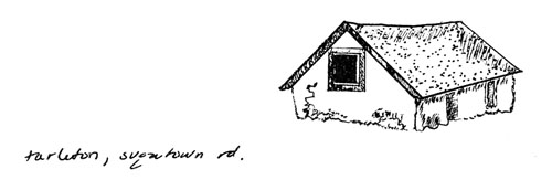
Tarleton Showtown Rd. |