|
Home : Quarterly Archives : Volume 41 |
Tredyffrin Easttown Historical Society |
|
Source: Summer 2004 Volume 41 Number 3, Pages 87–90 Early Photographs of Valley Forge Several primary sources allow us to put together a fairly accurate view of how Valley Forge must have looked when it was a mill community. The information on three maps and one view, and the photographs in the Library of Congress American Memories database all corroborate each other. Garry Wheeler Stone's map of Valley Forge around 1775 and the Valley Forge map in the 1883 Breou Farm Atlas are reproduced in Mike Bertram's article in this issue. A close-up of a section of Albert E. Down's lithograph of Valley Forge in 1890 is reproduced on the cover of this issue. The complete lithograph, a map of "'The Village' of Valley Forge circa 1893" prepared for Valley Forge National Historical Park in 1995, and most of these photographs are available in the Valley Forge section of the American Memories database. Many of the reproductions in this database were made for the National Park Service by the Historic American Buildings Survey of the 1930s and the Historic American Engineering Record of the 1960s and 1970s. Roger D. Thorne enhanced these digital images.
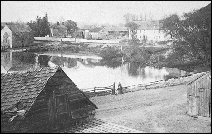
1859 view from one of the paired images on a stereoscope slide of the west end of the bridge over Valley Creek looking across to the area adjacent to what was the Isaac Potts house. This house is the building in the upper left corner with the twin chimneys. Stables and barns shown on the Stone map to the south of the house can be seen. On the opposite side of the road out toward the Schuylkill River is a building beside Valley Creek that was probably the grist mill. A gentleman leaning on the north side of the bridge is looking into the Creek.
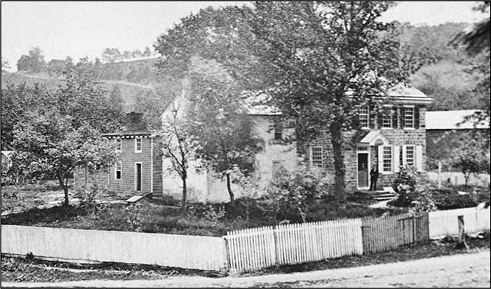
This photograph of the Isaac Potts house, later remodeled as Washington's Headquarters, is the same as shown on the 1890 Down's view on the front cover. The road in front of the house is clearly seen, as well as the rise in the upper left corner where the road that has become present day Route 23 was. The attached white structure was the kitchen. According to the January 24, 1879 edition of The Home News [Bryn Mawr], the Valley Forge Centennial Association purchased about 1 1/2 acres here for $6,000 from Mrs. Hannah Ogden, who would be allowed to occupy the "Headquarters" until her demise.
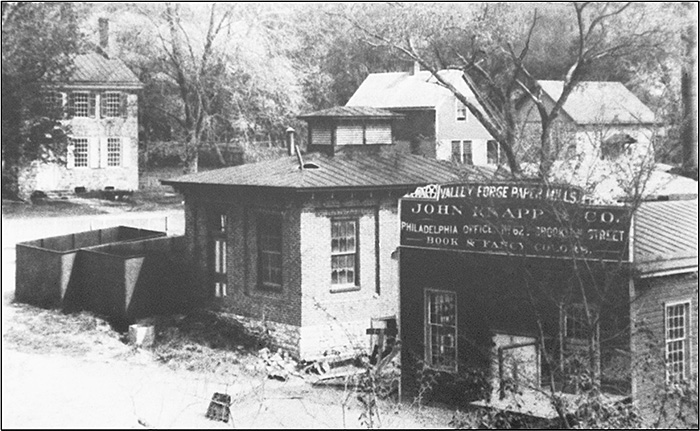
The twin buildings at the north end of the paper mill along Valley Creek across the road from the former Isaac Potts house are seen in this view. They appear on the 1883 Breou map as the American Palm Pulp Paper Company and are also shown on the 1890 cover illustration of this issue. According to the text on the 1893 map, the mill building on the left was a brick pump house. The sign on the top of the building on the right says "Valley Forge Paper Mills, John Knapp & Co., Philadelphia Office, [illegible] Brooklyn Street, Book & Fancy Colors.
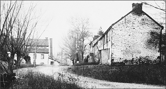
Mill workers stone houses are shown on the right across the road from the cotton factory buildings on the left. The road in the foreground is present day Route 252 and looks north toward the intersection with present day Route 23. These buildings are on the 1890 lithograph on the front cover of this issue. Lucy Sampson took this photograph around 1902. None of the buildings remain.
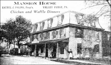
The Mansion House, shown on this undated postcard, was popular with tourists visiting Valley Forge Park during the 1876 Centennial celebration. It stood in the area where the von Steuben Memorial is now located along Route 23 towards Phoenixville next to the Valley Forge Post Office.
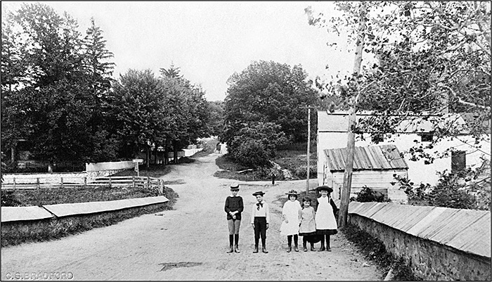
The children in this 1885 photograph are standing in the bridge over Valley Creek. The intersection of present day Routes 23 and 252 is in the center. This view looks east and the road going up the hill is Route 23. The Mill Road out to the Schuylkill River and present day Route 252 and are seen going from left to right across the middle of the picture. The large white building on the right was part of the cotton factory location. |