|
Home : Quarterly Archives : Volume 44 |
Tredyffrin Easttown Historical Society |
|
Source: Winter/Spring 2007 Volume 44 Numbers 1&2, Pages 9–11 The Roads Two roads vie for the title of oldest road in Tredyffrin. The Lancaster Road / Conestoga Road followed a Native American trail on the top of the South Valley Hills known as the Allegheny trail. Swedesford Road came into existence after the Swedes developed the ford near Norristown as a major crossing point of the Schuylkill River. Although we do not know when these roads came into existence, we do know when they were “laid out.” Local residents petitioned the Courts for a road. A jury was then given responsibility to survey a route and if there were not too many objections the road was approved and officially “laid out.” The township then took responsibility for maintaining the road.
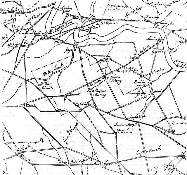
Clinton's Revolutionary War road map with the township boundaries superimposed Access to the grist mills was an important need for an early community. The first mill in Tredyffrin was what is now known as the Great Valley Mill on North Valley Road. A number of roads were laid out from this mill, the first one being in 1710. This road led to the Philadelphia Road and, unlike many of the early roads, cannot be located today. Swedesford Road was laid out in 1724 between the Conestoga Road, near present day Exton, and the Swedes Ford, near to present day Norristown. In 1735 the Welsh Line, Baptist, or Fatland Ford Road, part of which is now known as Valley Forge Road, was laid out between St. David's Anglican Church and the Fatland Ford across the Schuylkill, passing by the Great Valley Baptist Church. The Conestoga Road followed the Native American trail between the principal villages of the Conestoga Indians on the Susquehanna and Delaware Rivers. The road may have been laid out as early at 1701. The “King's Highway or Publick Road” to Lancaster, branching west from the Conestoga Road in East Whiteland was laid out in 1742, and parts of the Conestoga Road became known as the Lancaster Road The earliest existing detailed road map of the Tredyffrin area is shown on the previous page. It was drawn by British engineers for General Clinton during the Revolutionary War. It does not show all the roads that had been laid out (for example, Yellow Springs Road is not shown), but it does show the major routes, including those mentioned above. Once a road had been laid out, maintenance became the responsibility of the township. The Supervisor of Roads inspected the roads and organized maintenance work. Often this was not to the level desired by travelers, as can be seen from the following 18th century snippets: “...in our journey today, we found the roads so bad that we walked ye part of ye way, and climbed 3 fences to get clear of ye mud.” “...I could not get into a trot, but could not compare myself to anything but being chin deep in hasty pudding and obliged to trudge thro. The hills its true are not so slushy but are worn into lopsided ruts so as to be scarcely passable.” “... one of the wheels struck a stone 2 feet high when I was driving at a rate of 7 miles an hour you will not wonder that the shock was violent. Although I have to thank Heaven that I have no broken limb I am fearful of having for a long time to complain of a very severe sprained ankle.” Lancaster Turnpike / Lincoln Highway
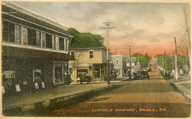
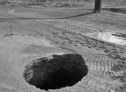
In 1792 the State authorized the incorporation of the Philadelphia and Lancaster Turnpike Company to construct a new “artificial” road between the two cities. The turnpike was opened in 1794, and was both the first major toll road and the first packed stone road built in America. Segments of the old road that were bypassed by the new and less circuitous turnpike became known as the Old Lancaster Road. The road was operated as a toll road until 1917, when it was bought by the State and became a public road. It is still sometimes referred to as the Lancaster Pike. Pike refers to the barrier placed across the road to halt travelers. Later the road became known as Lancaster Avenue. It became part of the coast-to-coast highway from New York City to San Francisco known as the Lincoln Highway, in honor of Abraham Lincoln. First envisaged in 1912, the road took many years to complete. Route 202 The modern era of roads began with the designation of Route 202 in 1935. Initially it was signed along Swedesford Road, up Bear Hill Road, and then across to and along Paoli Pike. Many plans have been produced for Route 202 over the years, but most have not come to fruition. The section from I-76 to the Route 252 interchange was upgraded in 1967 and the section west of this in 1968. The latest upgrade to Route 202 started in 1999. The Great Valley, through which the road passes, has limestone bedrock. Sinkholes are a natural part of such a geology and are a big construction problem in the Valley, with over 100 found in the township. These were a significant problem, as they had to be filled with a special grout. Over $17 million was spent in filling sinkholes.
Sinkhole at 202 / 422 interchange Part of the 422 interchange opened in early 2002. The Chesterbrook Boulevard interchange was rebuilt, the Boulevard being extended south to PA 252. The Swedesford Road interchange and the Valley Forge Road interchange also saw minor improvements. Further work was started in 2006, including the extension of the six lane section westwards to the Route 30 interchange. The Pennsylvania Turnpike The first section of the PA Turnpike was opened before World War II but the eastern terminus was west of Harrisburg. In 1950 the road was extended eastwards through the township and Valley Forge became the terminus. A number of the farms in the township had fields isolated by the barrier of the turnpike.
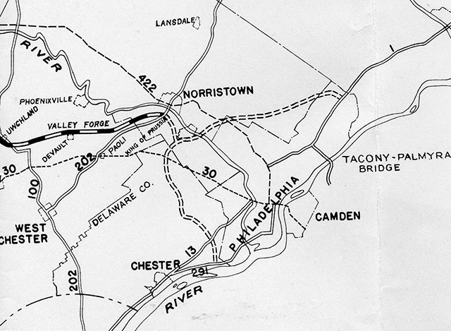
Proposed extensions to the Turnpike, 1948
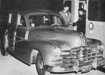
W.E. Rauth is the first to enter the Turnpike at Valley Forge. The extension to New Jersey was opened in stages between 1954 and 1956. The Schuylkill Expressway was also opened in stages between 1954 and 1959. Further local improvements to the turnpike are underway at the time of writing with expansion from 4 to 6 lanes and a proposed EZ-Pass only interchange with Route 29. |
| Previous Article ⇐ ⇒ Next Article |