|
Home : Quarterly Archives : Volume 44 |
Tredyffrin Easttown Historical Society |
|
Source: Winter/Spring 2007 Volume 44 Numbers 1&2, Pages 27–31 The Villages of Tredyffrin
Cockletown The first villages in the township were no more than informal collections of houses. Cockletown and Howellville vie for the title of the earliest village. Cockletown was on the Old Lancaster Road, in the area between Conestoga Road to the west, and the Berwyn Shopping Center in Easttown to the east. The name probably derives from the Cockle Burr, an imported weed troublesome to early farmers. The Old Drove or Drover was a tavern in the village. Occupations of people in the late 18th century in the community included weavers and a shoemaker.
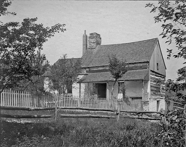
Neilly Cabin, Cockletown (still standing) In 1794 the Lancaster Turnpike was laid out and the community of Cockletown was by-passed. As a result, the center of the village shifted south so that it was mainly in Easttown Township. By 1861 the area had become known as Reeseville (after the Reese family who were long time inhabitants) and in that year a Post Office was opened under that name. Then the area became known as Berwyn from the Berwyn Hills overlooking the Dee Valley in Wales. In 1877 the name was given the official sanction of the Post Office.
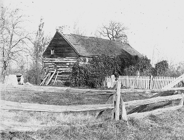
Reese Homestead, Cockletown (demolished) Howellville The village was named after the Howell family who owned the inn for at least 40 years. They were also significant land owners around the village.
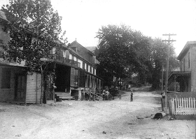
Howelville, 1910 The Inn at Howellville was first licensed in 1745, and may have been in existence as early as 1712. The tavern's site was an attractive place being on the important Swedesford Road. The road from the Great Valley Mill, laid out in 1710, may also have passed by the tavern. These roads were soon followed by Bear Hill Road (now Route 252) and Howellville Road. The first school opened in 1720. Other trades appeared as the village developed. There was a water-driven saw mill for many years, and a grist mill for a few. Up on Bear Hill Road was Baugh's tannery. By the late 18th century there was a shoemaker and wheelwright in the village. There was also a factory mentioned in tax records, but it is not clear what it produced. In the 19th century the grist mill was converted into a woolen mill that at one time employed 35 people. In the middle of the century the Chester Valley Railroad came into operation, and Howellville had its own station. The biggest industry was limestone quarrying. Italian immigrants arrived and formed the majority of the work force. The quarrying is discussed in a separate article. The quarries shut down in the 1930s causing great hardship in the village. The expansion of Route 252 in 1967, and then Route 202 in 1971 destroyed most of the village. Most of the quarry pits are now part of housing developments or office complexes, and only a few 19th century houses survive. 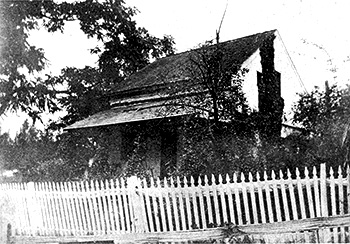
Roye cabin, built in 1714 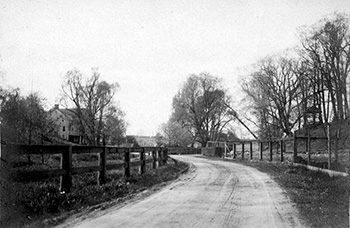
Daylesford: Glenn Road looking north Daylesford In 1714 the Roye log cabin was built in the area later named Daylesford by a Welsh settler. Remarkably this cabin is still in existence. The original Blue Ball Tavern, a noted establishment in the 18th century, was the next house to be built. When the new Lancaster Turnpike was built the old inn became less accessible. Around 1795 a second Blue Ball Tavern was built on the new road. The community acquired the name Daylesford in 1890 when the Pennsylvania Railroad built a station by that appellation. The name comes from either an estate in England or a resort in Australia. 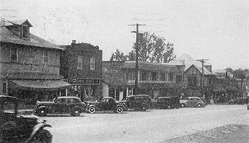
Route 30, Paoli 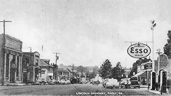
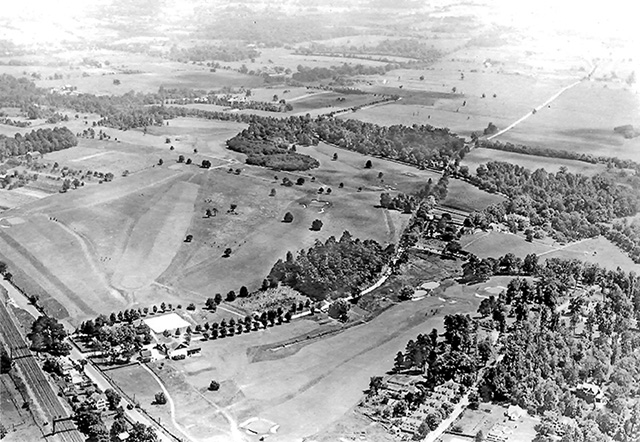
Paoli In 1719 William Evans purchased 500 acres of land on the South Valley Hills. His son, Joshua Evans, founded the General Paoli Inn around 1760, named in honor of Pasquali Paoli, the Corsican patriot. Joshua Evans Jr. became the first postmaster of Paoli in 1826. He was a political and military leader. The railroad opened in 1836 utilizing horse-drawn wagons and greatly boosting the Inn's business. By 1870 Paoli had the railroad station, a general store, and there was a second tavern in addition to the Paoli Inn. The development of the community was constrained by the limited ownership of land until the Evans farm of 329 acres was sold to the Paoli Heights Land Company in 1881. The company then sold the land in smaller lots for development. In the early 1900s Paoli was still rural in its eastern section. The Dingee farm occupied both sides of route 30. The southern part of the farm, together with the adjacent property, became the Tredyffrin Country Club in existence from 1918 to 1943. The part of the farm north of Route 30, including the farmhouse, was developed as the Burroughs Research Center that opened in 1954. It is now the Paoli Pointe condominium and assisted living community.
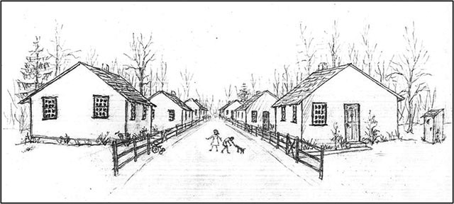
View looking south-east of the Tredyffrin Country Club with route 30 in the lower left corner. Cedar Hollow The history of the village revolves around the limestone quarrying, though initially the industry was on a small-scale informal basis. Prior to being known as Cedar Hollow, the village in the north-west corner of the township was called Clintonville. The first business in the village was a grist mill that was in existence in 1825. In 1833 the village contained 6 to 8 dwellings, a woolen manufactory (the converted grist mill), a store, and a tavern. The woolen manufactory was later converted into a paper mill. Large scale quarrying of limestone began in 1855 (see the article on the quarries). As the limestone industry grew, so did the need for workers. Men of many nationalities were recruited to work in the quarry. The Warner Company took over operations around 1900. It built 50 houses for its workers. These were mainly bungalows and frame houses.
In its time, the village of Cedar Hollow was self-contained. It had its own schools and churches, two general stores, a bakery, three bars, and a Republican Club (the quarry owners did not allow the workers to be Democrats). In 2000 the Trammel Crow Company took over the abandoned quarry site and announced plans to build a business park, converting the quarry hole into a scenic lake. Development is still underway at this time. Trammel Crow ceded the track bed of the spur railroad that had served the quarry to the township. Plans call for converting this into a trail one day. This trail would connect to the Chester Valley Trail that is being developed along the old Chester Valley rail bed. The eastern 60 acres of the quarry property were sold to the Open Land Conservancy and it now forms the Cedar Hollow Preserve. New Centerville New Centerville was a small village at what is now the junction of Routes 202 and 252. Its heyday was in the first part of the 20th century, before the development of Route 202 relentlessly ate away at its center. Now the remains of the village are barely discernible. A store opened in the village around 1828. The village was originally called Walkertown after the Walker family who were long time settlers in the area. Development of the village was spurred by the siting of a post office, and then the building of a station for the Chester Valley Railroad around 1852. At this time the name Centerville (from being at the center of the valley) replaced the earlier name of Walkertown. There was also a tavern, a hotel, a general store, and a small number of houses. In the 20th century the appearance of the automobile catalyzed the building of gas stations and a garage. The Valley Forge Music Fair operated to the south-west of the village between 1955 and 1996 (see article). 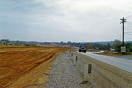
Route 202 being constructed through New Centerville in 1963.
In 1937 Route 202 was designated, using Swedesford Road initially as its route through the village. The widening of Route 202 to four lanes through the center of the village in the early 1960s signaled its demise. Soon afterwards the Gateway Shopping Center was built. The Chester Valley Railroad was abandoned in the late 1980s. Strafford The development of Strafford started in the 1920s. Frank McAdams built houses on Deepdale and Hillside Roads that were sold in the late 1920s and 30s. He received many of them back as mortgage defaults during the subsequent depression. They were rented until after World War II, when many of them were sold to returning veterans with G.I. mortgages. 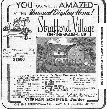
J. Howard Mecke, a realtor, built Colonial Village over the township line in Upper Merion in 1928. He then purchased 2 farms between Croton and Old Eagle School Roads and developed that area. In 1939 Stephan Schifter started developing Strafford Village between North Wayne Avenue, Crestline Road, and Beechtree Lane. The Village development was completed in 1949. |
| Previous Article ⇐ ⇒ Next Article |