
|
Past Meeting |
|
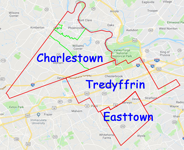
Interactive map of three local townships by Mike Bertram
|
A History of Three Local Townships by Mike Bertram Deeds are a great historical information resource. As well as providing information about the property, they also give information on the buyers, sellers, and neighbors. By drawing out the boundaries of a property and annotating it with the names of the neighbors, you can produce the pieces of the three-dimensional (time being the third dimension), jigsaw puzzle that is a deed history. Deed histories from the original patent from the Penn family to the end of the 18th century have been researched for three local townships, Tredyffrin, Easttown, and Charlestown. Interactive historical maps using Google Maps and the deed histories have been produced for specific dates during the 18th century for which additional information is available to further illustrate the township histories. This talk will discuss the process and issues in developing the deed histories, and will use the interactive historical maps to the illustrate the histories of the three townships in the 18th century. This presentation will be held at the Tredyffrin Public Library in Strafford, PA on Sunday 21 October 2018, starting at 2 pm. |
|
Page last updated: 2018-10-22 at 17:29 EDT |